This brief article introduces a basic comparative analysis of the inter-annual variation in tide in two locations in Narragansett Bay and how they affect environmental indicators (such as salinity, chlorophyll, temperature, and dissolved oxygen). The data was collected from two stations: Phillipsdale (station 1), which is situated in a shallow water region and exposed to greater levels of human activity, and Conimicut Lighthouse (station 2), which is farther away from the urban area and preserves more natural conditions. In this talk, we investigated the possible impact of the annual variations in tidal elevations on environmental indicators, primarily focusing on salinity. The findings reveal that the average monthly tide heights are notably higher during early fall (August to October) than early spring (February to April). This further leads to increased horizontal flow, vertical upwelling, and turbulent mixing and results in salinity increases and chlorophyll blooms in both stations. As we advance, similar analyses will allow us to characterize the tidal nature of other estuaries of a similar kind, such as Chesapeake Bay in Virginia.
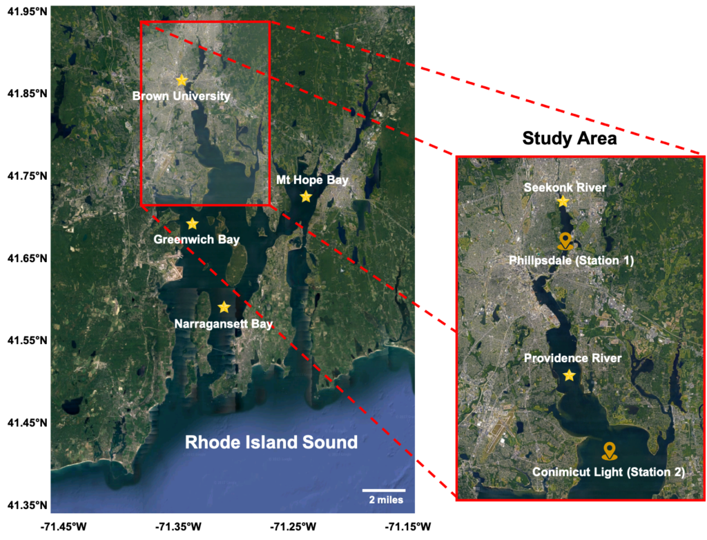
Snapshot taken from Google map (02/14/2023) over Narragansett Bay, including some of the Rhode Island Sound. The boxed area shows our stations.
The detailed project report is highlighted in this document.